|
| *****SWAAG_ID***** | 58 |
| Date Entered | 11/01/2011 |
| Updated on | 14/12/2011 |
| Recorded by | Tim Laurie |
| Category | Burnt Mound |
| Record Type | Archaeology |
| Site Access | Public Footpath |
| Location | West Burton CP. Pasture below Morpeth Wood. |
| Civil Parish | Not known |
| Brit. National Grid | SE 029 880 |
| Altitude | 230m |
| Geology | Springs rising below the Middle Limestone and crossing terrace formed by the Simonstone Limestone.
BGS Sheet 51. |
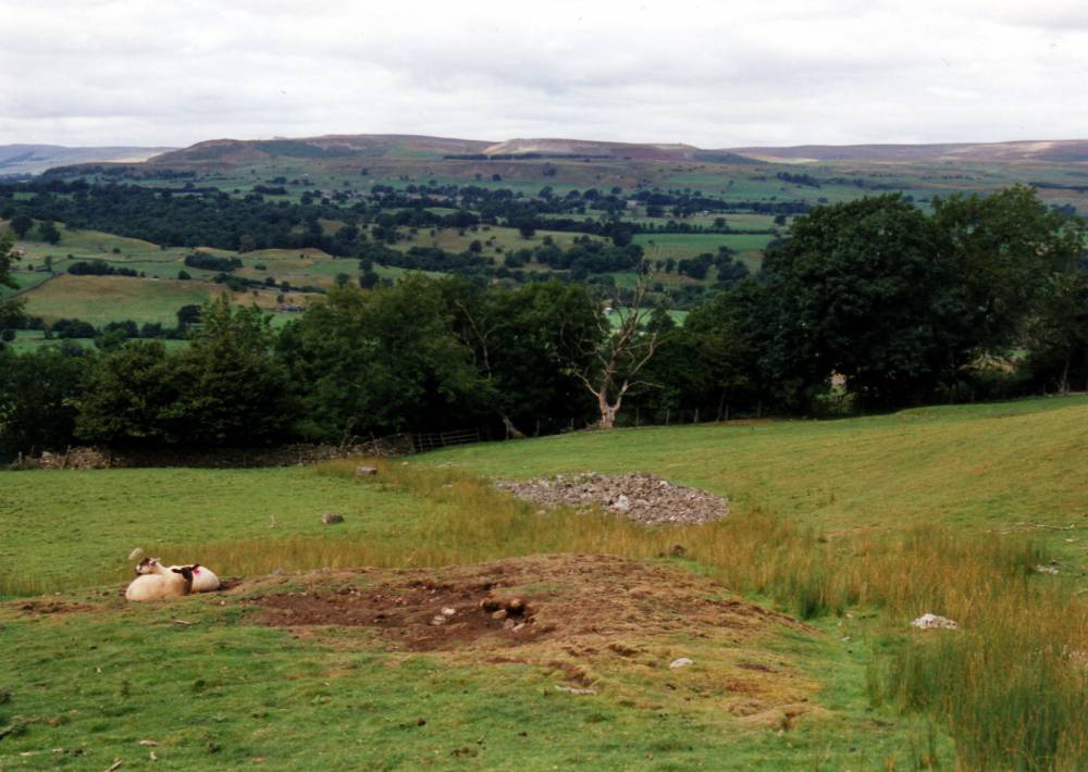
| Record Name | Burton cum Walden CP.Two Burnt Mounds below Morpeth Wood the upper reused as a lead bale. |
| Record Description | BURTON CUM WALDEN C.P.
Morpeth Wood. 2 Sites. One site re - used as lead bail.
Both sites at springs. Site 1 is large and very prominent in pasture above the footpath. For Lead Bale, See Record No 141.
Site 2 is less obvious and located at a spring rise adjacent to the field wall below the footpath |
| Dimensions | Site 1. Large, medium. Site 2. Medium ,low. |
| Additional Notes | Indicative Dimensions of burnt mounds:
Size: Small <6m, Medium 6m-9m, Large 10m-15m, Extra large >15m.
Height: Low <0.5m, Average 0.5-1.0m, High >1.0m.
NOTE!
For details of the four burnt mounds in Pasture above Morpeth Gate, see Record No 57. |
| Image 1 ID | 351 Click image to enlarge |
| Image 1 Description | Morpeth Wood. Burnt Mound reused as a lead bale. |  |
| Image 2 ID | 352 Click image to enlarge |
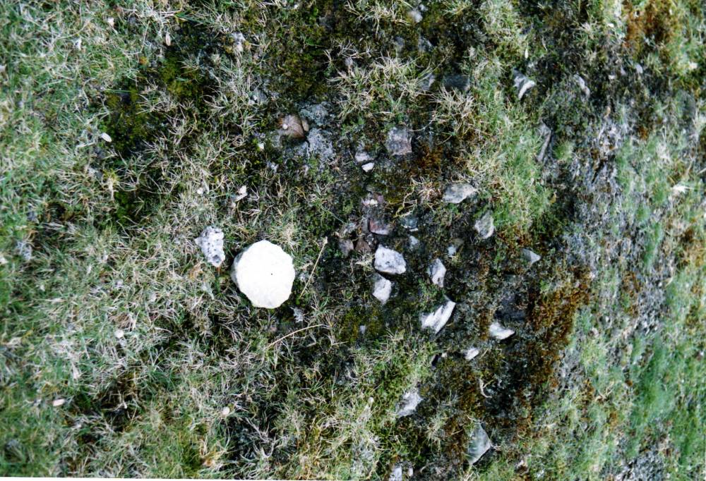
| Image 2 Description | Detail of burnt stone with stone stopper from medieval ceramic jug. |  |